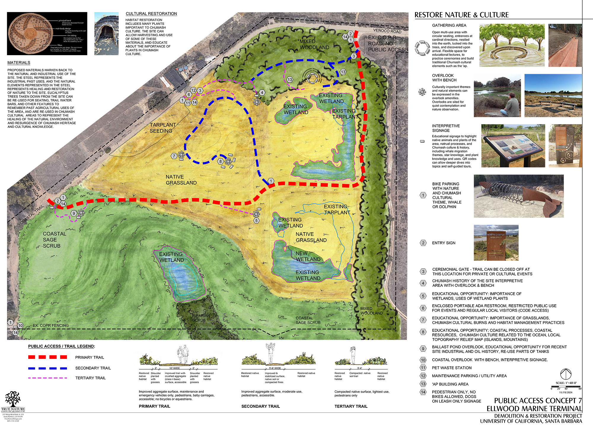
We’re excited to be leading the restoration of the Ellwood Marine Terminal site for public use. This involves removing the facility’s tanks, pipes, and associated buildings and screening trees to provide 360-degree ocean and mountain views. The restoration vision includes rebuilding the historic high point that was leveled when tanks were installed in 1929 and restoring a variety of native grasses, wetlands, scrub, woodland, and coastal dune habitats. As part of this restoration process, it’s important for us to understand what types of activities and signage local community members would like to see available at the site. The map below outlines potential public use options, including gathering areas, overlooks with benches and/or blinds for bird watching, interpretive signage, and a variety of trails that differ in difficulty, width, and length.
Since May 2023, the Cheadle Center and Strategic Earth have been conducting an outreach program to design and develop a framework for public access at the Ellwood Marine Terminal site. This program has included three site tours with Chumash listening sessions and public surveys in June, an open invitation for one-on-one discussions with the Chumash community, and a Chumash listening roundtable to explore cultural opportunities at the site. Following these efforts, a public webinar was held, accompanied by another engagement survey made available online. In consultation with planners, a public access conceptual plan for the site was developed. The above plan emphasizes low-impact amenities that maintain the site’s tranquility while providing space for private Chumash cultural activities and gatherings. We welcome your feedback and ideas on this concept. Please share your thoughts by emailing ncos@ccber.ucsb.edu. Also, if you would like to receive communications and updates about the restoration project, please subscribe to our newsletter.
